Day 40 – Gone fishing

Today everyone but me went fishing for the Lake of the Woods spirit animal, the Muskie, with Jamie from Bruce Canadian Angling. (They didn’t catch one.)

I took the truck for an oil change.

(I also had a coffee and some apple strudel at Second Street Bakery, and when the day got too hot to think in, I swam in the Lake (of the Woods!) at the Anicinabe Campground.)

Then Alexe and I dropped by Green Adventures to borrow a couple of boats from Scott, and we went for a peaceful paddle down the river through the cattails and marsh, and out into Laurensons Lake where we just floated down the shore with our hands in the blessedly cool water.

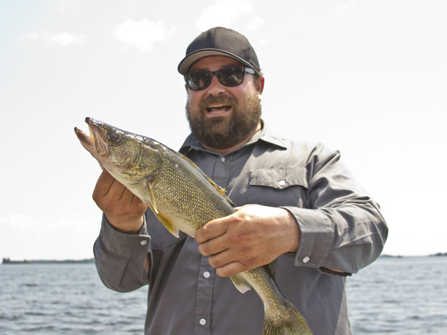
When we got back to the camp, Jamie had just been by to deliver the cleaned and filleted walleye they’d caught in the morning, and we ate it for dinner. (It was good.)

Tomorrow — The Kenora farmers’ market to pick up some fresh produce, then heading east to Ignace, stopping at Busters Barbecue on the way for some award-winning barbecue sauce!

Photo by Alexandra Sawicki
Day 39 – Go west, young man

Today, we drove as far west as you can in Ontario, on a road. We started the day at lovely Caliper Lake provincial park, and headed up through Sioux Narrows and all the little bays and fishing lodges of Lake of the Woods, to Kenora, a city of neverending water.

It’s such a nice old town, with a sweet main drag and tons of outdoor outfitters to get you out in the wilds. There’s a lot of history to be proud of here too, from the days of old Rat Portage, and the Kenora Thistles taking home the 1907 Stanley Cup! The unofficial mascot of the town, Huskie the Muskie, holds court in the guise of a huge sculpture on the shores of the lake.

To get into the spirit of Kenora’s watersport activity, Mike learned a thing or two about paddling, and the bottom of the river, from Scott at Green Adventures.

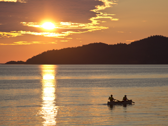
After sweating out the heat of the afternoon swimming at Anicinabe Campground, we headed out into the sunset for a mad dash to Manitoba. They don’t call this Sunset Country for nothing! It was a gorgeous drive.

After a quick photoshoot at the border, we made our way back downtown and slunk into the cool movie theatre half an hour late for Spiderman – there’s something about going to the movies on a road trip that feels so decadent.

Tomorrow — When in Rome… going fishing for Muskie!

Photo by Alexandra Sawicki

Day 38 – Wild rice & burial mounds

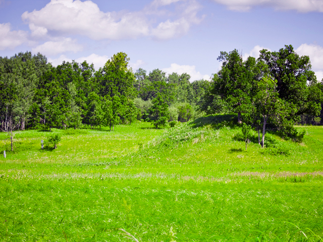
This morning we visited the past at the Kay-Nah-Chi-Wah-Nung Historic Centre. Built on the banks of the Rainy River, the Ojibwe interpretive centre tells the story of the Place of the Long Rapids, where for thousands of years people lived and gathered. Also known as Manitou Mounds, this place  — only 40 miles from the headwaters of the Mississippi — was at the centre of a continent-wide trading network for close to 8000 years. Traces of Ojibwe villages are found among the burial mounds and village sites of more ancient aboriginal peoples.

The burial mounds range in age from 300 to 8000 years old, and are spread along the banks of the river from the Rainy River First Nation to Rainy River. In more recent history, Ojibwe people would travel up the Rainy River to Lake of the Woods every year for the wild rice harvest. If there were any deaths during the important harvest, the bodies would be left on burial platforms along the river until the harvest was over, and then the bodies were collected and brought to the Place of the Long Rapids to be buried with ceremony.

The shoreline of the river in this area has been untouched by development, yet was a trading hub for people from all over North America. Seeds from far-away plants took hold, and now grow wild next to many of Ontario’s rarer plants in the native Oak Savannah Prairie. Sitting under a tree on the crest of a hill above the rapids, the scent of wild sage on the warm wind, it’s easy to imagine huge canoes filled with the rice harvest fighting their way up the busy water. There is something very special in the air here.

Nico, our guide, invites us to help rebuild a mound that was bulldozed before the area was under Ojibwe guardianship. Here, we walk counter-clockwise, back in time, to honour the spirits of the past. A handful of tobacco — in the left hand, it’s closest to the heart — is placed on the new mound, along with a handful of dirt from the old mound.

The Historic Centre also is home to a traditional roundhouse, which hosts frequent ceremonies. The interpretive centre itself, which opened in 1994, has beautiful displays of the history of the area, from the Archaic Culture through the Laurel and Blackduck and finally the contemporary Ojibwe people. There’s even a cozy little wigwam where I secretly had a lie-down after my close encounter with a gigantic piece of coconut cream pie in the aptly named Hungry Hall. We all feasted on wild rice casserole with fry bread and bannock, but I slyly stuck around after lunch for a chat with chef Lorraine and some dessert. Even without electricity, the meal was delicious.

The power came back on just in time for us to have a look around the lovely gift shop, which specializes in locally made Ojibwe arts and crafts.

We made our way to Caliper Lake provincial park, where we camped right on the water, and watched the sunset through the leafy green canopy above us.

Tomorrow — West we go!

Photo by Alexandra Sawicki

Day 37 – A little light housekeeping

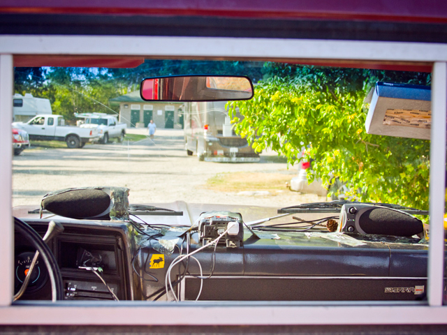
After 8000km, we finally have a sound system! Mike and Alexe splurged on $14 computer speakers and some sweet camo duct tape and got this party started. It’s kinda too bad we didn’t have it a few hours earlier for our epic drive from Thunder Bay to Fort Frances (yes, epic for us is 350km) but at this point we’re used to silence while we’re on the road. Or, to be more precise, nothing remotely like silence — a numbing cacaphonic blend of rushing wind, thumping and clanging of metal ramps in the bed of the truck, engine roar, a loose belt whining, the trailer hitch grinding and clanking, and the whirr of the inverter charging our various technologies. So let’s just say the stereo is great for anything under 60km/hr, and after that it becomes another interesting background rhythm.

The drive itself was pretty glorious — highway 11 is a nice cruisy road. We stopped halfway, in Atikokan, for gas and a nice lunch at the White Otter, and then kept on going til we hit Fort Frances. Beautiful endless causeways lead into town along highway 17; there’s a real striking difference in the amount of lake there is around here… like Muskoka only on a much larger scale, and with the highway right in the middle of it all. It’s a stunning drive.

It was far too hot for too much exploring in Fort Frances, but we found a motel (originally we were planning on camping in the next town, but at this point we all really needed the air conditioning) across the street from Canadian Tire (hence the speakers and camo duct tape) and hit the beach at sunset, only to see three white pelicans flying in tandem low across the lake. That’s normal here! I’m really starting to feel I’m somewhere else.

After some cold beverages and wild rice soup at Le Rendez Vous on the waterfront, we crammed back into the cab of the truck and pumped up the jams, singing along to old soul as we cruised the strip back to our motel at twilight.

Tomorrow — Heading back in time at the Kay-nah-chi-wah-nung Historic Centre!

Photo by Alexandra Sawicki

Day 36 – History lessons and cinnamon buns

We spent the morning chinwagging with Lorne and Joan Saxberg, who own the general store and teahouse in Silver Islet. When we arrived for coffee, Lorne warned us he might not have much time to talk as he and Joan were looking for their runaway cat, Pepe, who had escaped the house. Luckily Pepe was found sharpish and after some diligent petting we settled into the tearoom for fresh cinnamon buns and a few yarns.

Just offshore at the end of the Sleeping Giant peninsula, the Silver Islet mine was the richest in Canada, producing over $3 million in silver by the time it closed around 1883. In those days, there was no road down the peninsula — miners and their families arrived by boat or dogsled from Thunder Bay, depending on the season. Bachelors lived in bunkhouses out on the little islet by the mine shafts; families lived in little log cabins on the peninsula. All that’s left of the islet now are the mine shafts underwater, a few old miner’s cabins along the ‘Avenue’ in town, and the old store building right on the wharf — and judging from the old photos on the wall of the tearoom, it looks pretty much the same now as it always did.

The Saxbergs purchased the store in 1987 with their son Lorne, a CBC Newsworld anchor who drowned in Thailand in 2006. They keep it going in memory of their son, otherwise “I’d be retired,” says Lorne Sr. When their children were young, Lorne Sr. worked building logging roads in the area, and would often bring his kids along for the trip. He says they’d visit the store, and it would always be closed, so years later, when Lorne Jr. saw it was for sale, he put in an offer, “out of some romantic idea,” his father says, laughing. But it wasn’t until it had been hit by lightning that the previous owner was satisfied with the Saxbergs’ offer — and so there was a lot of renovating to be done before they opened for business in 1989.

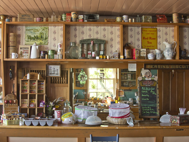
The teahouse and store are full of knick-knacks the Saxbergs found in the cellar and attic when they moved in, and make the building feel like a living museum. Locals must love it — all 675 of them — for along with Joan’s homemade cinnamon buns and pies and hearty daily soups, Lorne scoops up ice creams and peddles penny candy in the front of the store. If you’re ever caught in the rain at Sleeping Giant, or just need a little treat, the cozy tearoom has a great view of the channel and feels like a lovely place to spend a thoughtful afternoon. Joan also hosts a moonlight tea on Saturday nights.

We drove away as the rain started, and headed for Thunder Bay. After checking into the Days Inn – wireless and a hot tub! And a free breakfast waffle machine. What else do you need? — it was straight to the Hoito for Finnish pancakes and egg salad Piirakka to take the edge off.

Tomorrow — We go west!

Photo by Alexandra Sawicki

Day 35 – Oh the nature

It was lazy today.

Sleeping Giant has a lot of trails. I hear they are amazing. Last year we didn’t have enough time to do anything more than the pretty Lion’s Head trail out to the famous rock formation, so this year I specifically booked us an extra day at Sleeping Giant so that Alexe and I could do some serious hiking. But I opened the park booklet late last night to ponder what we should attempt today, and I read words like ‘challenging’ and ‘sheer cliff’ and ‘bring extra water’ and I just didn’t want to. So Alexe and I instead drove past the jam-packed-full parking lot for the prestigious Kabeyun and Giant’s Head trailheads, and headed down the back of the 587 loop that leads onto the Avenue in Silver Islet. The parking lot for the Middlebrun & Finlay Bay trailhead was empty at 11:30am — perfect. The park guide calls this an ‘easy hike to a secluded sandy beach’ through a wetland. Obviously more our speed on this blisteringly hot day. And it was lovely. After only two kilometres through shady forest, the trail spits you out at one end of the glorious Middlebrun Bay, and the sandy beach that stretches for almost a kilometre. The trail continues down the beach to the other end, and heads into some storm damaged bush, with chainsawed ends of fallen trees lining the path.

Finlay Bay was rocky, with those neat shallow pools the waves rush over in little eddies and spit up through the cracks. We lazed there for hours, skinny dipping, becoming sunburnt, toes tucked into the little pools to cool us down. We swam again passing back through Middlebrun — I was so heatsoaked I just sat in the cold water up to my neck to cool down. The beach is beautiful, and only a 20-minute walk through the brush. By that time, more people had arrived with kids and dogs and picnics. We were starting to get hungry, so we headed out to explore Silver Islet at the end of the road.

Last year both Alexe and I had really liked Silver Islet, but hadn’t gotten a chance to really look around. We finished the loop from the trailhead, and headed down the ‘Avenue,’ the one-way road that separates old miner’s houses and clapboard summer cottages from the sandy beach. The houses butt up against a rocky cliff, and as the community is off the grid, feature solar panels and generators. The population of Silver Islet is about 650 in the summer; 7 in the winter. It’s my kind of town.

We drove slowly down the street to soak in the local colour, then stopped at the General Store for a visit with the Saxbergs and a couple of warm homemade cinnamon buns.

Tomorrow — more Silver Islet! And then off to eat Finnish pancakes at the Hoito in Thunder Bay.

Photo by Alexandra Sawicki


Day 34 – Death-defying feats of grandeur

Thank goodness Lake Superior is so cold, because it was meltingly hot this morning by 9am. Alexe and I started our day with an invigorating swim in the icy calm lake, and then moved the picnic table into the shade so that we wouldn’t die of exposure while I made pancakes for breakfast. Well, they were sort of a mash-up of pancake and crepe. Pretty good, actually. And we ran out of propane at the exact second the last pancake was alllmost done but still edible! Miracles.

We stopped on our way west to explore the sleepy village of Rossport, nestled between the water and the train tracks. A long freight chugged through town while we were there, right along the back of the houses that line the waterfront. The town is quite pretty, with fishing boats almost everywhere you turn. The Rossport Caboose Museum is first on the strip, then the Forget-Me-Not gift shop — specializing in the unique and unusual since 1964 — that seems to be open only on Mondays (?) but has a “husbands’ waiting bench with scenic view” out back of the shop; the pretty Serendipity Cafe peering out over verdant gardens; several bed and breakfasts and rental cottages; and Superior Outfitters & Ecoventures, a kayak touring and instruction operator and paddling shop.

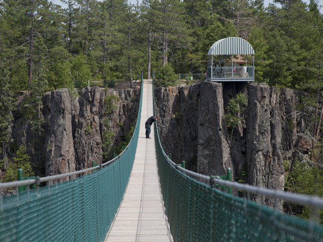
After stopping in Nipigon for some groceries, beer, and a trip to the post office (hi Grandma!), we dropped Mike and Bogdan off in Eagle Canyon, home of Canada’s longest, highest, and fastest zipline. After crossing two suspension bridges (one of which is also Canada’s longest — stretching 600 feet across, and 152 feet above the canyon floor), they made it to the top, where Mike promptly strapped on safety gear and jumped. And got heatstroke.

Alexe and I went swimming in Marie Louise Lake in Sleeping Giant provincial park.

When the boys got back, we made miniature homemade hamburgers and aluminum foil potatoes over the campfire – we’re getting good at this – and perfectly roasted marshmallows. Sleeping Giant is one of those family campgrounds where there are kids everywhere, bikes and dogs and fishing rods flying by, and everyone says hello. Our site backed on to the lake, with a little path through the bush, and we could watch the sun setting through the trees. A very Ontario experience.

Tomorrow – tea at Silver Islet, mayyybe a hike depending on the weather, and hoping we don’t run out of gas before Thunder Bay.

Photo by Bogdan Stoica


Day 33 – Adventures on the big water

Mike and I lay on our elbows at 2am, half asleep and eyes glued to the sky as the entire length of the horizon exploded in a red glow, over and over. The black clouds above Lake Superior were backlit by the moon, the lightning illuminating only a sliver where the water met the sky. The wind was warm, but ripping off the water and tugging violently at the canvas covering the tent trailer. We must have lain there for 20 minutes, just watching, and exclaiming gently at the occasional white lightning bolt, before the rain came and we zipped up the windows and fell back asleep.

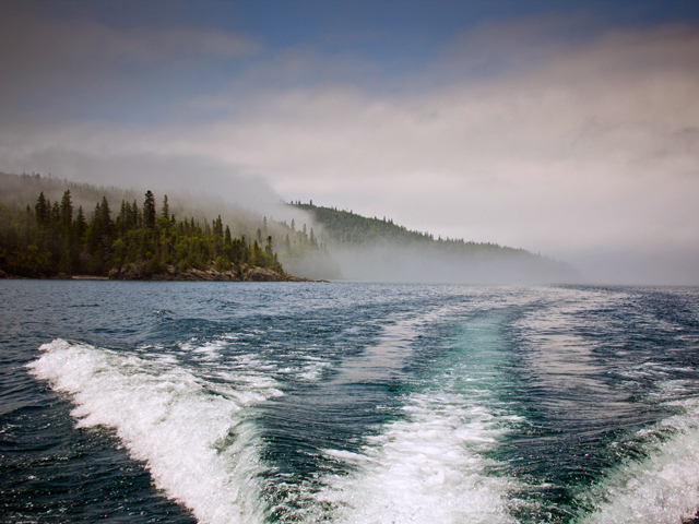
By noon, we weren’t sure how our planned boat tour of the Slate Islands would unfold – mist rolled over the highway on the way to Terrace Bay from Neys, and the water was all but completely obscured with fog cover. We met Captain Come Castongauy of Bluebird Charters at the Terrace Bay dock, and headed out on the 20km crossing. There was fog all around and for most of the trip we couldn’t see any land anywhere. But as we rounded the point and cruised into the sheltered bays, the fog rolled away like magic, and the sky was blue and bright.

The Slate Islands are home to a large herd of woodland caribou, a species at risk in Ontario. Captain Come told us that about 60 years ago, the caribou arrived on the islands by crossing the ice on the frozen lake. But that part of Lake Superior didn’t freeze the next winter, or the next… and 60 years later, the caribou are still stranded. But they have no natural predators on the islands and there is no hunting allowed, so the species will probably stick around for a while.

We arrived at Fisherman’s Cove, a tiny little clearing with a dock, where Bluebird Charters drops off campers who want to stay for a few days, with their canoes, kayaks and camping gear. There were caribou tracks on the beach, but no animals. After exploring a dilapidated old fishing shack and investigating the woods for caribou poop, we headed out to the shattercones – 450 million year old remnants of a meteor strike, basically the solidified form of an instantaneous volcano, eroded by time. To an untrained eye, though, they just look like a big reddish rock cliff. But knowing the story makes it seem kind of surreal — to imagine that a 19km wide meteor slammed into the earth exactly where your boat is drifting, and that gigantic wall of rock was its molten backsplash. It’s pretty amazing.

Our last stop was  a decommissioned lighthouse high on the cliffs on the big water side of the Slates. Captain Come sent us up a lush green path behind the beautiful old lighthouse-keeper’s cottage — past monstrous rhubarbs and a burbling freshwater brook — that lead us up to the light on the flat rocks at the top of the cliff. An abandoned red-roofed fishing village huddled on the beach down below. The view was breathtaking, almost coastal – like, ocean coastal – in feel. The other day, Bogdan, who had never seen Lake Superior before, said, “if you told me that was the ocean, I’d believe you.” And up on that cliff, I’d believe it too.

As the sun lost its fury, we made our way to the tiny Rossport campground in Rainbow Falls provincial park, our last night of camping on Lake Superior. It’s a lovely little spot, with spacious grassy sites right at the water’s edge. The smooth, rounded red rocks and windblown white spruce silhouetted in the rosy sunset — as the moon rose over the the rocks across the bay — were the quintessential image of Lake Superior’s shoreline. In the dark, the full moon reflecting on the water and Mike’s campfire were the only lights we could see.

Well, that and his iPhone. Total coverage!

Tomorrow — We head for Sleeping Giant, and Mike risks his life on the Eagle Canyon zipline!

Photo by Alexandra Sawicki


Day 32 – Up in the air

While we were in the Soo, we were generously offered a float plane ride with White River Air. None of us had ever been on a float plane before, so we were entirely willing to get out of bed three hours earlier than usual to experience this traditional Northern Ontario mode of transportation.

And it totally blew our minds.

We’ve covered a lot of road on this trip, and we’re going to cover a lot more by the time we’re through. We have seen a lot of beautiful and amazing things. But the country itself can feel two dimensional from the road — even though there are hills and cliffs and trees and valleys and ponds and lakes all around us. It’s all different from the air.

The cabin of the tiny De Havilland Beaver, built in 1949 — serial number 47! — and lovingly maintained, shakes and growls with the propellers as we cruise down the lake on its floats, warming up the engine. And it doesn’t get much quieter once we’re in the air.

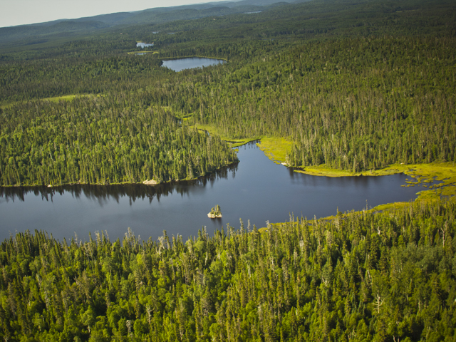
Ontario is so huge. So so so vast and deep. And seeing it from the air, flying low so that textures and topography are clear, it really becomes apparent how much of it we’re missing. How much is kept secret from the casual explorer, who sticks close to the roads and amenities (although we’ve got lots of gorgeous roads to explore too). The sturdy beaver dam in a murky tea-coloured river, the shores of a turquoise pond lined with fallen grey conifer trunks. The bald spots left by a recent jumping forest fire; green new growth from a not-so-recent one. Sun-spattered lichen on those big Shield rocks, great mounds of that same rock rising 50 metres out of the ground with ancient cedars clinging to the flanks. Trails of lazy lakes lie like drips from a paint brush, changing colour all the way to the horizon.

Needless to say, it was quite the experience.

Tomorrow — a boat trip out to the Slate Islands with Bluebird Charters!

For more information on motorcycle routes, accommodations, attractions and restaurants in Algoma Country check out www.RideAlgoma.ca

Photo by Alexandra Sawicki


Day 31 – Stay gold, Canada

Watching the sun set tonight at Agawa Bay — on the shores of the largest freshwater body of water in the world, golden green shards of beach grass fluttering in the breeze, our toes curled in the white sand, everything bathed in amber — I think we were all feeling pretty lucky that this country is here for us to explore.

For more information on motorcycle routes, accommodations, attractions and restaurants in Algoma Country check out www.RideAlgoma.ca

Photo by Alexandra Sawicki